BlackSky is the first geospatial service to combine multi-sensor imagery with timely and relevant data feeds and analytical services to enhance your understanding of the world as events happen.
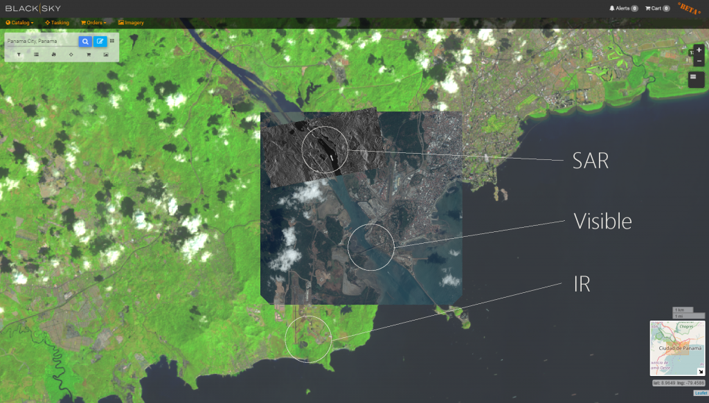
Today, we’re excited to announce BlackSky Spectra — our on-demand imagery service. This new name better reflects how the service uniquely enables you to look at the planet across every spectrum, from visual imagery to other sensing modalities such as synthetic aperture radar (SAR), hyperspectral images, radio frequency detections, video, and more. With more types of information available in the online catalog and tools to fuse this data in time and space, you’ll gain broader insight into global events.
Consider this scenario: Responding to an impending typhoon, a humanitarian group employs BlackSky Spectra to obtain recent and seasonally correlated images of the affected island. The group pinpoints new population centers at the outskirts of existing cities and analyzes transportation networks and port congestion. As the storm hits, Spectra provides access to SAR imagery to pierce the cloud layer and provide broad-scale tracking of threats to inhabitants and damage to critical infrastructure. The combination of responsive imagery from SAR, visible, and other sensors enables prioritization and coordination of multi-agency relief efforts.

Here’s why BlackSky Spectra is more valuable (and way more than just a cool name).
- It’s continually expanding.
With BlackSky Spectra, you can access imagery from our global sensor network which includes many satellite-based sources. Today, the catalog includes access to 12 high-resolution spacecraft and over 25 million images…and it’s growing every single day. Images can be purchased and downloaded from Airbus’ Pléiades, SPOT6/7, KazEOSat-1, and TerraSAR-X, 21AT’s TripleSat, UrtheCast’s Deimos-2, SIIS’s KOMPSAT, and soon the BlackSky constellation. Further, BlackSky has agreements with emerging providers, such as Hawkeye 360 to expand the variety, ubiquity and richness of our data offerings. Much more to come here. - You can drive (or specifically, point and shoot).
If you can’t find the images you need in the catalog, you can reliably task satellites in our virtual constellation directly from BlackSky Spectra. Again, this is as easy as selecting the location on a map (or defining a custom area) and saying how often you want a picture taken. - It goes back in time.
With BlackSky Spectra, you can quickly discover images in the catalog by searching on location, resolution, date taken, or specific vendor. No more hunting and sourcing imagery from several sites — with BlackSky Spectra, images are always available. Using the catalog to source archive images provides a baseline view of a specific location and is a powerful tool for monitoring change over time.
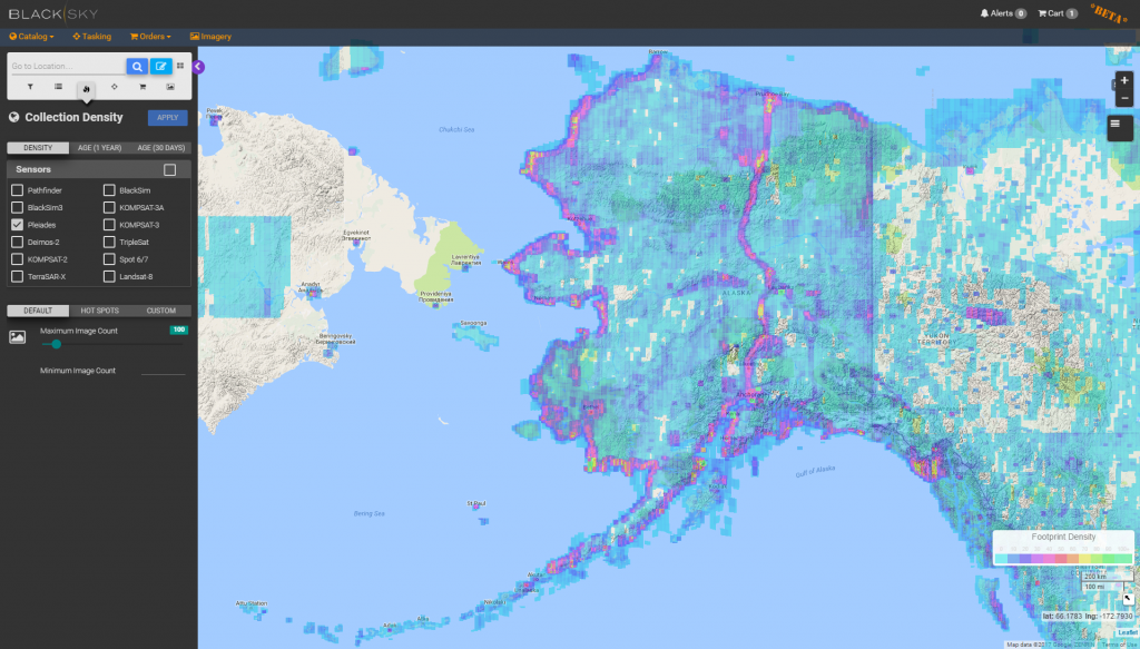
Additionally, Spectra can show collection density over any area for any sensor worldwide. This gives users a very easy way to determine how often an area is imaged and how many images exist for the area in the selected time period. This is key for change detection analysis.

We’ve been busy fine-tuning BlackSky Spectra with early customers to ensure the user experience is revolutionary. We hear consistently the convenience of sourcing all types of imagery from BlackSky Spectra is a clear ‘wow’ factor.
Stay tuned — much more to come.
Jason

